Mount Union borough
A Question We Cannot Settle, and Maybe You Can
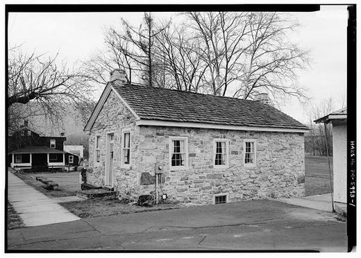
This stone house stands on West Water Street near Division. The federal survey records it as the John Sharrar House and dates it to about 1841. The photographer noted that the gable end you cannot see in this picture was the canal side, because the Pennsylvania Mainline Canal came through here in 1829 and Mount Union started life as a canal village.
Here is the honest problem. The county's 1937 history says the town was laid out in 1840 by William Pollock, for John Sharrer. The Historic American Buildings Survey says the town plan was laid out and lots offered for sale in 1849. Both are serious sources and they do not agree, and we are not going to pick the one we like better.
So we will ask.
Sources
- LOC caption pa2853.photos.038950p (HABS PA-5993, dated ca. 1841)
- HABS PA-5974 p.3 (founded 1849; canal routed 1829)
- Sesqui 1937, Mount Union entry (laid out 1840 by William Pollock for John Sharrer)
Checked 2026-09-01 · Historic Mount Union collection